FIND MY DRONE
FIND MY DRONE is a FREE App developed by Communis Tech that connects your iPhone to your personal UAV (unmanned aerial vehicle) using the popular MAVLink protocol.
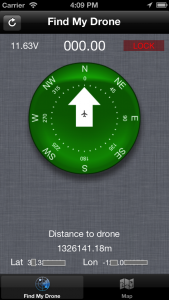
If you were forced to land your drone some distance away, this convenient App will determine the latitude and longitude of the drones’ location and its’ distance from you. The inbuilt compass can then direct you to the drone, saving you a haphazard and time consuming search.
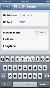
In addition, the “Manual Mode” allows you to use the search function even when us
ing an alternative autopilot. Just enter the last known coordinates from your drones’ telemetry and FIND MY DRONE will calculate the bearings and direct you to that location.
To connect using MAVLink you’ll require a WiFi network link (wiring diagram to be posted soon). Alternatively you will soon be able to use a Bluetooth low energy to long-range radio adaptor, we’re working on it now so stay tuned.
Features of FIND MY DRONE include:
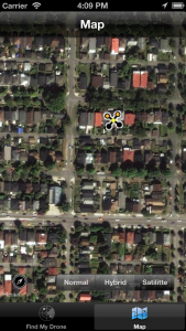
- MapView with drone location plus device location shown
- Current System Status i.e. RTL (return-to-launch), STABILIZE, LOITER… etc.
- FIND MY DRONE will remember the last received coordinates even if the drone’s power fails
- FIND MY DRONE view includes;
- compass indicating your orientation and direction of the drone from your current position
- current battery voltage information (if you have an active lock)
Stay tuned, FIND MY DRONE will be followed soon by MAVPilot, a ground control station for your pocket. If you’re interested in becoming a tester go here to sign-up.
Check it out in the App Store now!


Hi,
Very good work for creating a Iphone app!
I have a question regarding the connection with the app?
Is it possible to use a raspberry pi as wifi bridge and connect to the raspberry pi instead of the method you propose?
i found a link which describes the set-up:
http://dev.ardupilot.com/wiki/making-a-mavlink-wifi-bridge-using-the-raspberry-pi/
Thanx
Yep you can use the Raspberry PI as a WiFi hub and connect using MAV Pilot.
Nice app!
I use a goose autopilot and it’s GCS streams NMEA messages. I’d like to spin a simple app that takes those NMEA messages and jams them into the Mavlink protocol that FINDMYDRONE is expecting. Can you tell me if you are reading GLOBAL_POSITION_INT(#33) or some other message? Does the app need any other messages to work properly? I’d like to use FINDMYDRONE with a small Mavlink emulator server I will build to bridge the data from the goose. Thanks for any tips you can provide. Cheers!
Hi
Can you shared the source code?. I’m developing for Parrot ARDrone with ios. And I stuck. I need a example to continue.
I have iphone 4S and iOS 7.1
Thanks
Lizbeth
How could I connect “the usb 3DR 915/433MHz Telemetry Radio”
I would like to test it…
what device would I have to buy? for “Bluetooth low energy” to long-range radio adaptor
Thanks,
Mauricio
Hi, BLE support is not yet working, but you can use WiFi to 433Mhz Bridge see https://www.communistech.com/blog/support/
Nice work. Any plans for an android version?
Thanks. We can look at an android version of FMD if there is enough interest. The main focus now is to release MAVPilot for iPhone.